
La Palma’s Cumbra Vieja volcano started erupting in September 2021, spewing out ash and sending out rivers of lava that engulfed more than 1000 homes. It continued for 85 days but was declared officially over on Christmas Day and 2000 evacuated residents were allowed to return home. Now all is back to normal, although there’s still an exclusion zone around the volcano as the crater is still visibly releasing gases.
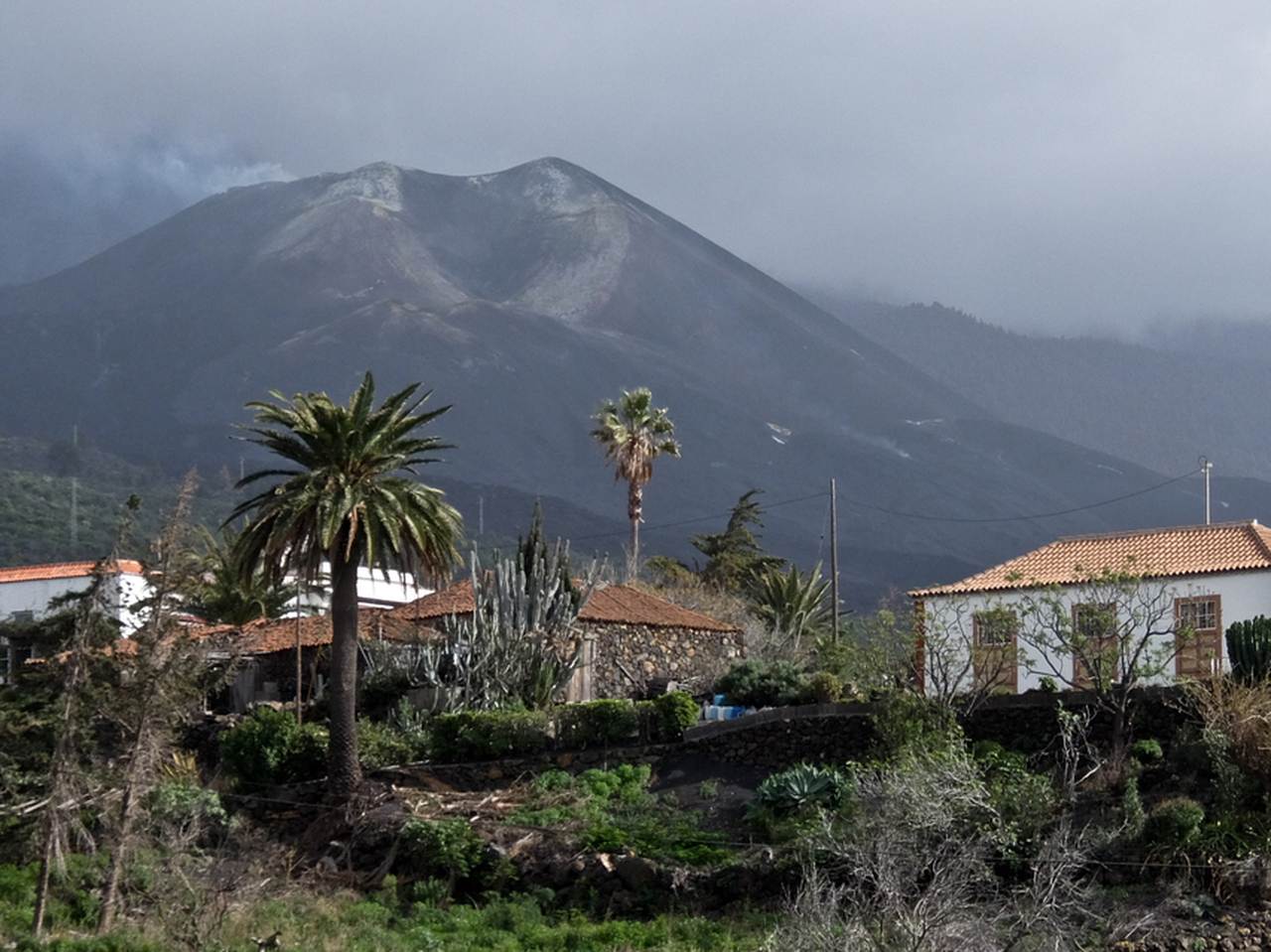
Volcano in the distance
Even though I can’t get close, I can see smoke coming from the volcano and the fresh lava fields carpet the hillside all the way down to the sea. In early spring the almond blossom is out, figs oranges and lemons hang from the trees, and it’s easy to see why La Palma is called Isla Bonita, the beautiful isle.
On a previous visit, I walked the Ruta de Los Volcanes, but part of that is now out of bounds. Not to worry as the island is honeycombed with walking routes.
Day 1: Tijarafe to Porís de Candelaria and return, 10km 4 hours.
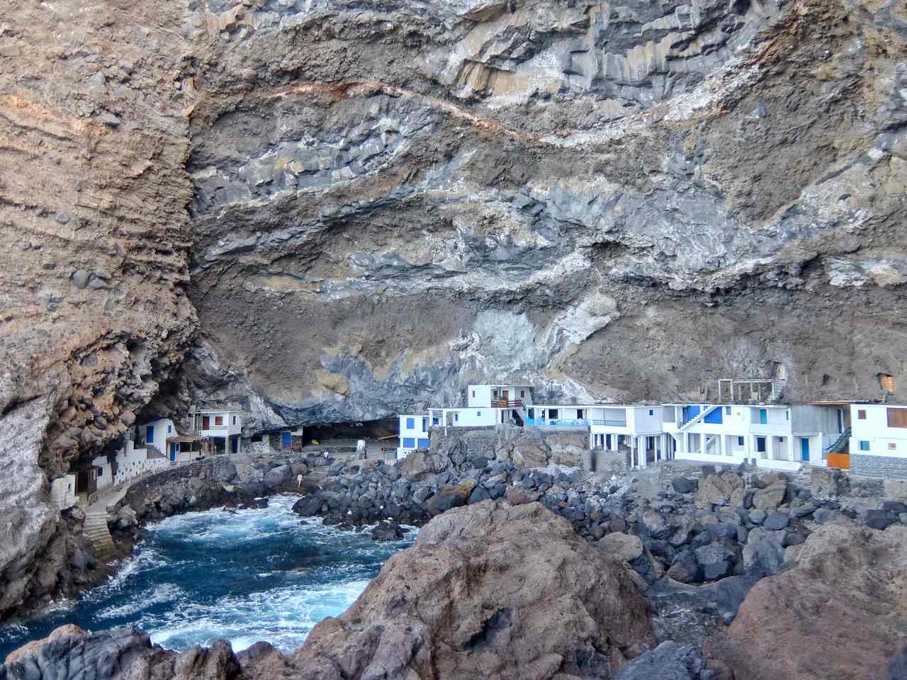
Poris de Candelaria
Up on the west coast, far from the volcano I start at the village of Tijarafe, perched high on the hillside overlooking the sea. It’s a steep descent on a zig-zag path, hugging the side of a canyon, the Barranco de Jurado, the water getting closer all the time. Hidden in the cliffs at the bottom is Poris de Candelaria, a cluster of fishermen’s houses lining the port.
It’s a perfect place for a refreshing dip, although there’s no beach and it can be tricky getting out of the water if it’s rough. To return, I have to cross the Barranco and then descend again to the Playa del Jurado, with a few buildings. Then the long haul upwards, following a line of pylons which once carried a cable to transport supplies. The path is solid but steep and it’s a relief to reach El Jesús, a small white chapel, to enjoy the view. From here there’s an easy path back to Tijarafe.
Day 2: Roque de los Muchachos, Pico de la Cruz to Pico Nieve 15km, 5 hours.
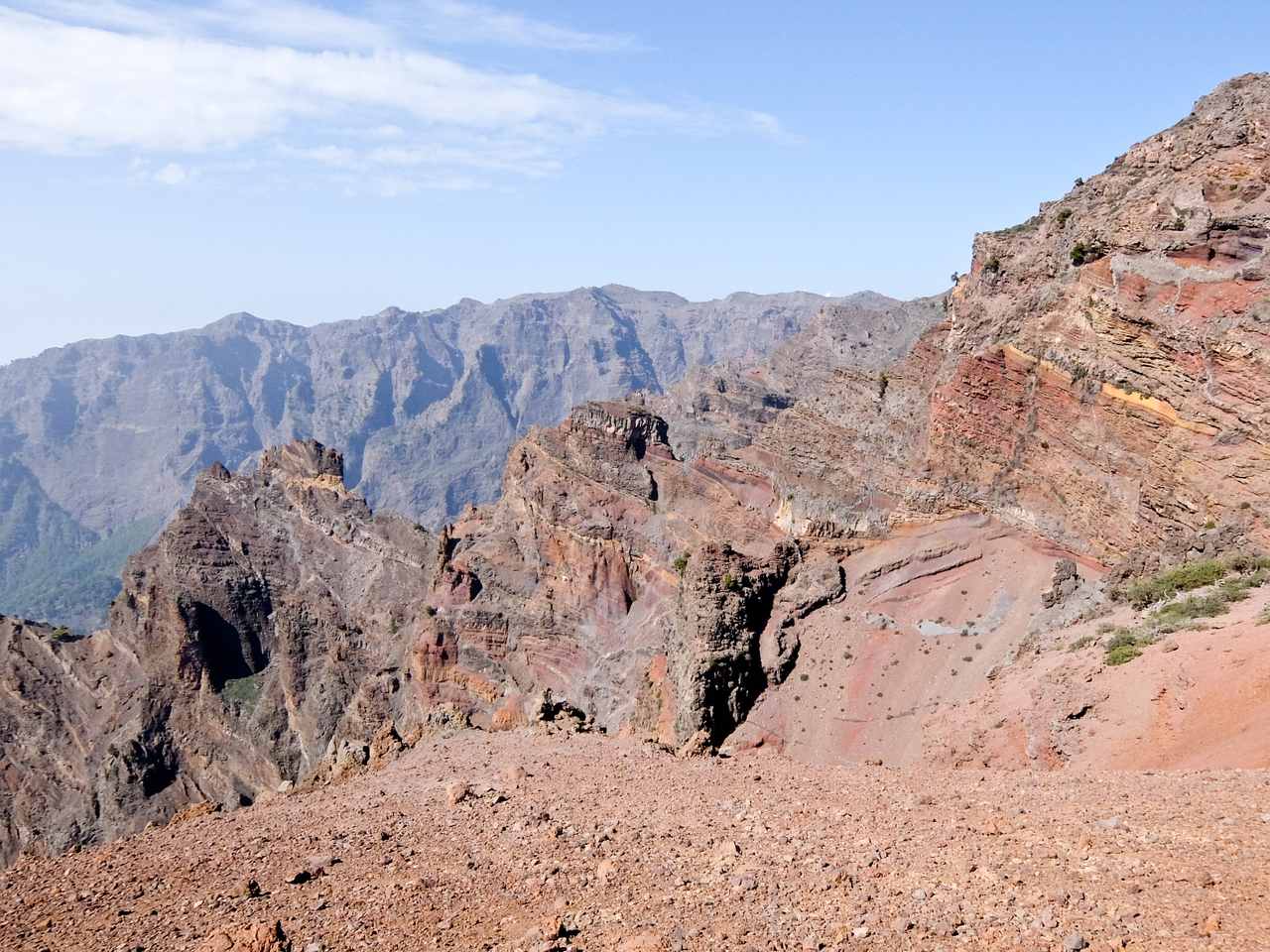
Volcanic layers Pico de la Cruz
I drive up into the volcanic heart of La Palma, formed around two million years ago, and home to numerous observatories taking advantage of the clear night skies. From Roque de los Muchachos, at 2426m, a path signposted GR131 for Refugio del Pilar leads me along the rim of the volcanic crater. It’s mainly level and there are glorious views across to the other peaks and down to the crater floor.
I pass Pico Fuente Nueva, at 2366m, and, after crossing a gap Los Andenes, climb up to Pico de la Cruz. From here, across the sea, I can make out other Canary Islands, El Hierro, La Gomera and Tenerife. It’s a little gritty underfoot, as I drop down below Pico de Piedra Llana, but I’m soon climbing up to the cross on the top of Pico de la Nieve, at 2239m. From here it’s a gentle walk down through pine trees to the road, where I’ve arranged a taxi to take me back to the car.
Day 3: El Tablado to Gallegos 12km 4 hours
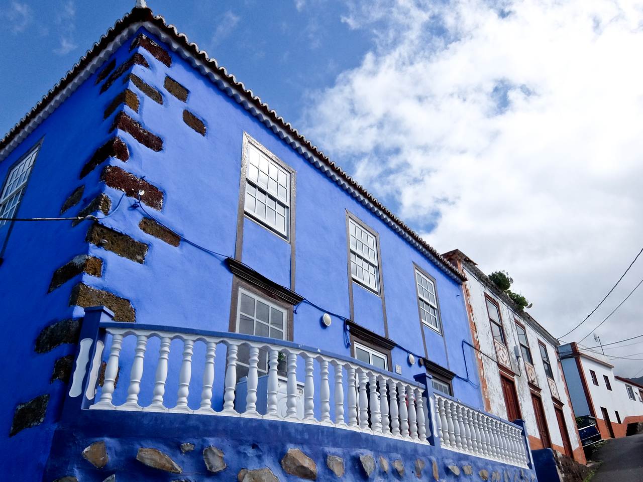
Gallegos
The GR130, Camino de la Costa, encircles La Palma and the toughest part is along the Northern coast, crossing deep canyons or barrancos, a series of hard ups and downs.
I start at El Tablado, a cluster of houses clinging to the hillside and drop down the side of Barranco de los Hombres on a stone-paved path.
The scenery is dramatic and, at the bottom, I make a detour to La Fajana, a hamlet among banana plantations. A small wharf has been built to transport the fruit, and I help myself to some prime specimens,
It’s a steep climb up the side of the barranco to the village of Franceses, on the main road. I pause for breath at a mirador and am rewarded by dramatic views of this wild coast.
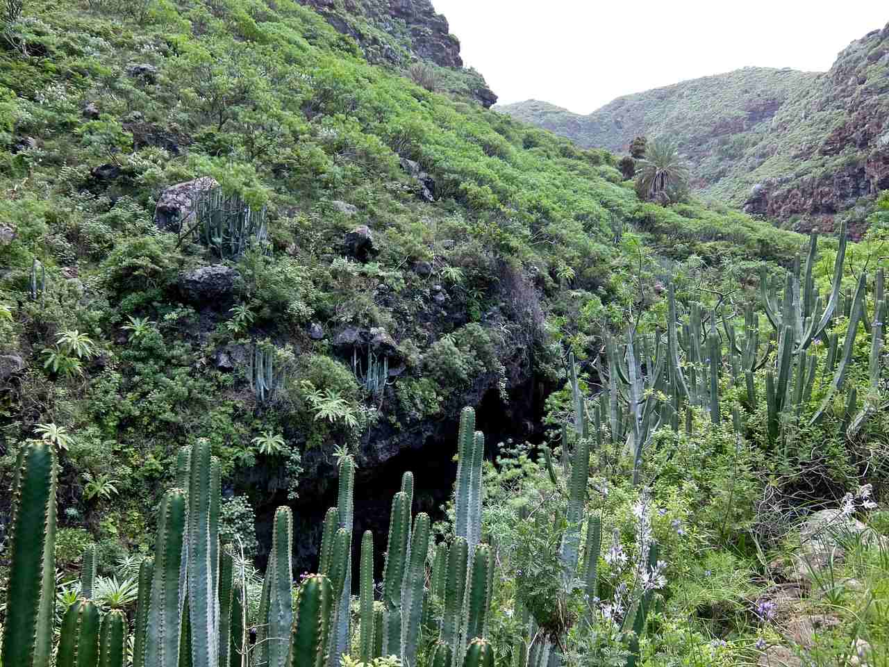
Cactus in Barranco de Franceses
There’s yet another canyon to cross, the Barranco de Franceses, and the path zig-zags down through masses of tall spiny cactus, tabaibal and cardón. At the bottom, I follow the dry bed of another Barranco before climbing through banana plantations to Gallegos. Unfortunately, the bar is closed.
Fact File
FLY: Tui flies direct on Thursdays from Gatwick to Santa Cruz.
STAY: Hotel H10 Taburiente Playa **** in Los Cancajos makes a comfortable base near Santa Cruz.
MORE INFO:
- Hiking paths are well signed and excellently maintained and
- Senderos de la Palma has up-to-date information.
- There’s a good bus network but you’ll need a car to get to the high points.
- Cicerone’s Walking on La Palma, by Paddy Dillon, is an excellent guide.
- Visit La Palma has information about the island.